gINT Software Products for Geotechnical and Environmental Professionals
Since 1986 gINT has offered innovative solutions to help engineering professionals manage geo-data and generate customizable reports. Today, gINT's innovative, powerful and time-saving software solutions are used by leading transportation authorities, state and federal agencies, and civil engineering firms worldwide.
There are many advantages to gINT and particularly Version 8.2. First, gINT offers a user-friendly relational database system that enables the user to fully control the design of databases, reports and symbol libraries. An unlimited number of database types and report styles can be created. The customizability of gINT enables you to get exactly the types of results you desire.

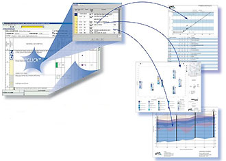
To make data entry easy, Version 8.2 of gINT also offers a choice of input modes: the standard spreadsheet-style mode, or the new Graphical User Mode.
gINT is available as four different products. Click here to see a detailed comparison sheet for the various products:
- gINT Pro
- gINT Logs Plus
- gINT Logs
- gINT for ArcGIS(r)
gINT Professional
gINT Professional is gINT's all-inclusive cornerstone product, offering
eight different report styles including borehole logs, fence diagrams,
graphs, histograms, graphical tables, text tables, text documents and
graphical text documents. Because gINT is completely customizable, an
unlimited number of reports and databases can be defined within each
report style. Powerful import and export capabilities and sophisticated
data interrogation tools help gINT interface well with other industry
programs. The program also contains built-in drawing tools for reports,
symbols and general applications, as well as a built-in PDF-generator.
gINT Logs Plus
gINT Logs Plus has nearly all of the functionality of gINT Pro, but
with a limited range of reports (borehole logs and text tables only).
Logs Plus is a perfect choice for professionals needing extensive
import/export capabilities (for example, AGS and CSV files) but needing
a program for production of borehole logs only. Logs Plus also
offers the gINT drawing tools, native PDF generation and the ability to
do database queries in input, as in the higher-level gINT products.
gINT Logs
gINT Logs is a cost-effective solution for those who desire a fully customizable solution for borehole logs only. This program offers the same sophisticated gINT technology that works behind the scenes in all gINT products to make log generation easy and completely customizable. Like other gINT Products, gINT Logs has a native PDF generator and offers a choice of data input modes, spreadsheet or graphical user interface, making data entry user-friendly. Upgrades are available from this product to a higher-level gINT product should the need arise for additional functionality in the future, protecting your initial investment in gINT.
gINT for ArcGIS
gINT for ArcGIS is an extension to ESRI's ArcGIS program that enables users to view and work with gINT data from within the ArcGIS program. This product requires at least gINT version 5 or later (any level) and ArcGIS version 8 or later.
gINT for ArcGIS enables you to:
- Import gINT projects into ArcGIS projects
- Select and view gINT project data within ArcGIS
- Preview and print gINT borehole logs within ArcGIS
- Export gINT data from within ArcGIS
- Work more efficiently by accessing gINT data directly.


